


-
-
Home
- About Upazila
-
Upazila Porishod
Minutes of Upazila Committee meeting
-
Upazila Agriculture and Irrigation Committee
-
Upazila Youth and Sports Development Committee
-
Upazila Public Health, Sanitation and Clean Water Supply Committee
-
Upazila Secondary and Madrasa Education Committee
-
Upazila Law and Order Committee
-
Upazila Primary and Mass Education Committee
-
Upazila Communications and Physical Infrastructure Committee
-
Upazila Women and Child Development Committee
-
Upazila Agriculture and Irrigation Committee
- Administration
- Municipality
- Govt. Offices
- e-services
- covid-19 vaccine
- সর্বজনীন পেনশন
- Deputy Commissioner Office, Gaibandha
-
-
Home
-
About Upazila
Upazila Introduction
History-Tradition
Geographical and Economic
Other
-
Upazila Porishod
Upazila Porishod
Upazila Parishad monthly meeting minutes
Minutes of Upazila Committee meeting
- Upazila Agriculture and Irrigation Committee
- Upazila Youth and Sports Development Committee
- Upazila Public Health, Sanitation and Clean Water Supply Committee
- Upazila Secondary and Madrasa Education Committee
- Upazila Law and Order Committee
- Upazila Primary and Mass Education Committee
- Upazila Communications and Physical Infrastructure Committee
- Upazila Women and Child Development Committee
- Administration
- Municipality
-
Govt. Offices
Law and order matters
Health related
Agriculture, fisheries, livestock and food related
Engineering and Information & Communication Technology
About Human Resources Development
Education related
- e-services
-
covid-19 vaccine
Online registration
-
সর্বজনীন পেনশন
registration
-
Deputy Commissioner Office, Gaibandha
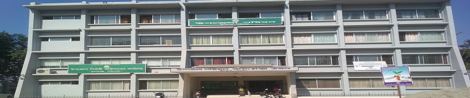
District Administration, Gaibandha
At a glance Sundarganj
| 01 |
Name of Upazila |
: |
Sundarganj |
|
|
02 |
Naming |
: |
In the early sixties there were 13 Indiras in this area (on the outskirts of Sundarganj Upazila Sadar) and there were beautiful women in this neighborhood. They used to bathe in these Indiras. Besides, people from different parts of the country used to celebrate Muharram every year. The upazila has been named (according to the so-called) Sundarganj by the combination of Ganj and the beautiful women's bus. |
|
|
03 |
Area of the upazila |
: |
369.85 sqr km |
|
|
04 |
Population of the upazila |
: |
5,01,837 people. (According to the 2022 census) |
|
|
|
Male |
: |
2,43,012 people. |
|
|
|
Female |
: |
2,58,825 people. |
|
|
|
Total Household | : | 1,37,866 |
|
|
05 |
Population density |
: |
about-- | |
|
06 |
Industrial establishments |
: |
No |
|
|
07 |
Cold storage |
: |
01 (one) |
|
|
08 |
Number of police stations |
: |
01 (one). Police investigation center 02 (two). |
|
|
09 |
Creation of Sundarganj Upazila |
: |
In 1973. Thana was established in 1985. |
|
|
10 |
Distance from Gaibandha district headquarters to the upazila: |
35 km |
||
|
11 |
Boundaries |
: |
Ulipur and Chilmari upazilas of Kurigram district on the north, Gaibandha Sadar on the south, Jamalpur and Roumari and Rajibpur upazilas of Kurigram district on the east, Mithapukur and Pirgachha upazilas of Rangpur district on the west. |
|
|
12 |
Landform |
: |
In Sundarganj upazila, out of 15 unions, 04 unions are hotspots surrounded by rivers. মা The soil of 04 unions is Do-Ash, Bele Do-Ash and medium high-low lands. There are also etel soils in other unions and sandy loam soils in some places. |
|
|
13 |
Rivers flowing through the upazila |
: |
Teesta, Brahmaputra and Ghaghat rivers. |
|
|
14 |
Parliamentary area |
: |
29-Gaibandha-1, Sundarganj. |
|
|
15 |
National best educational institution |
: |
Shivram Adarsh Government Primary School, Chaitantala, Sundarganj. |
|
|
16 |
Number of municipalities and unions |
: |
Municipality-01 (one) and Union-15 (fifteen). |
|
|
17 |
Number of mouzas |
:110 (one hundred and ten). |
||
|
|
Number of villages |
: |
146 (one hundred and forty eight). |
|
|
|
Ward number |
: |
09 (nine) in the municipality and 09 (nine) in each union total 135. |
|
|
18 |
Land office |
: |
Upazila land office-01, union land office-12. |
|
|
19 |
Educational Institutions |
|
|
|
|
|
Junior secondary school |
: |
MPO registered - 02 Without MPO - 06 |
|
|
|
Secondary school |
: |
MPO registered - 70 Without MPO - 04 |
|
|
|
School and college |
: |
MPO registered - 02 Without MPO - 01 (Higher Secondary) |
|
|
|
Higher Secondary College |
: |
MPO registered - 03 Without MPO - 02 |
|
|
|
Degree college |
: |
MPO registered - 06 Without MPO - 00 |
|
|
|
Dakhil Madrasa |
: |
Member of MPO - 38 Without MPO - 03 |
|
|
|
Alim Madrasa |
: |
MPO registered - 03 Without MPO - 01 |
|
|
|
Fazil Madrasa |
: |
MPO registered - 03 Without MPO - 01 |
|
|
|
Vocational school |
: |
MPO registered - 01 Without MPO - 00 |
|
|
|
Technical College |
: |
MPO registered - 05 Without MPO - 03 |
|
|
|
Diploma Institute |
: |
MPO registered - 01 Without MPO - 02 |
|
| Independent ibtedayi madrasa |
MPO registered - 05 (received grant) Without MPO - 82 (without grant) |
|||
|
|
Government College |
: |
01 | |
|
|
Government secondary school |
: |
02 |
|
|
|
Government Primary School |
: |
259 |
|
|
20 |
Literacy rate |
: |
64.81% (2022 census) |
|
|
21 |
Religious institutions |
: |
|
|
|
|
Mosque |
: |
501 |
|
|
|
Temple |
: |
70 |
|
|
|
Churches |
: |
No |
|
|
|
Pagoda |
: |
No |
|
|
22 |
Scheduled Bank |
: |
09 |
|
|
23 |
Cinema Hall |
: |
N/A |
|
|
24 |
Upazila Hospital |
: |
|
|
|
|
Sub-Center (Union Health Center) |
: |
06 |
|
|
|
Approved position of doctor |
: |
15 |
|
|
|
Number of ambulances |
: |
01 |
|
|
|
EPI coverage |
: |
Satisfactory. |
|
|
|
X-ray machine |
: |
|
|
|
25 |
Housing project |
: |
02 |
|
|
|
Number of resettled families |
: |
480 |
|
|
|
Shelter project |
: |
05 |
|
|
|
Ideal village |
: |
02 |
|
|
|
Guchhgram |
: |
05 |
|
|
|
(Ashrayan project) | : | 1767 |
|
|
26 |
Agriculture Relevant |
|
|
|
|
|
Arable land |
: |
34535 hectare. |
|
|
|
One-crop land |
: |
1575 hectare. |
|
|
|
Two-crop land |
: |
19812 hectare. |
|
|
|
Three-crop land |
: |
11701 hectare. |
|
|
|
Four-crop land |
: |
1447 hectare. |
|
|
|
Dedicated |
: |
239.07 hectare. |
|
|
|
khas land |
|
142.61 hectare. |
|
|
|
|
|
|
|
|
27 |
Croping intensity |
: |
Corn, Pepper, Rice, jute, and nuts. |
|
|
28 |
Government Hat Bazaar |
: |
39 |
|
|
29 |
Government Animal Hospital |
: |
01 |
|
|
|
Sub-Centre |
: |
03 |
|
|
30 |
Sanitation coverage |
: |
|
|
|
|
Drinking water from tube wells |
: |
100% |
|
|
31 |
Number of NGOs |
: |
37 |
|
|
32 |
Birth Registration Coverage |
: |
87.64% |
|
|
33 |
Problems |
: |
Due to river erosion, 23% of the land is lost in the river bed. Surrounded by 6 union rivers. At present (1) Kapasia, (2) Haripur, (3) Belka, (4) Chandipur Union is prone to river erosion during the monsoon season. |
|


Planning and Implementation: Cabinet Division, A2I, BCC, DoICT and BASIS
Technical Assistance:
![]()
Developed By:
